The Zodiac killer was last seen the night of Oct.
11, 1969. After killing cab driver Paul Stine in a San Francisco neighborhood called
Presidio Heights, Zodiac was observed by witnesses as he fled north on foot. Minutes
later, an alleged encounter took place between Zodiac and unsuspecting police officers.
But where did Zodiac go from there?
Page 3 of Zodiac's Nov. 9, 1969 letter to the San Francisco Chronicle might contain
the answer. Using statements from witnesses, simple logic and (most importantly) Zodiac's
own words, here is Zodiac's likely escape route...from start to finish: |

Page 3 of Zodiac's Nov. 9, 1969 letter to the Chronicle.
The accurate detail certainly makes it appear this crime was extremely well-rehearsed.

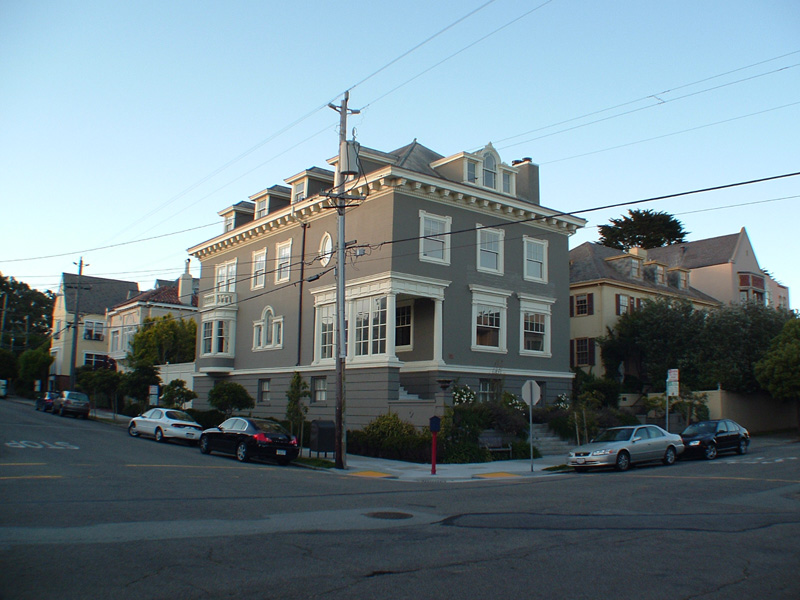
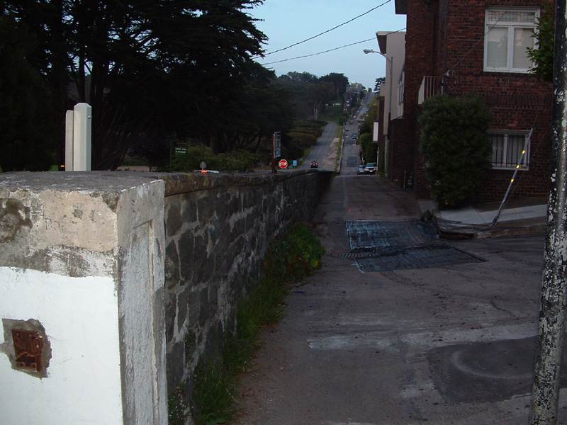
An overview of the crime scene and likely
escape route.

The victim's cab was parked in the same
approximite location as the silver car at the right of this picture. It was there Zodiac
began his escape, walking around the immediate corner (to the left) on the sidewalk and
heading north, slightly uphill.

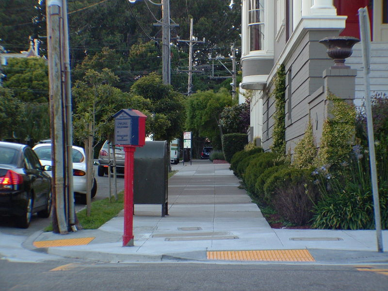
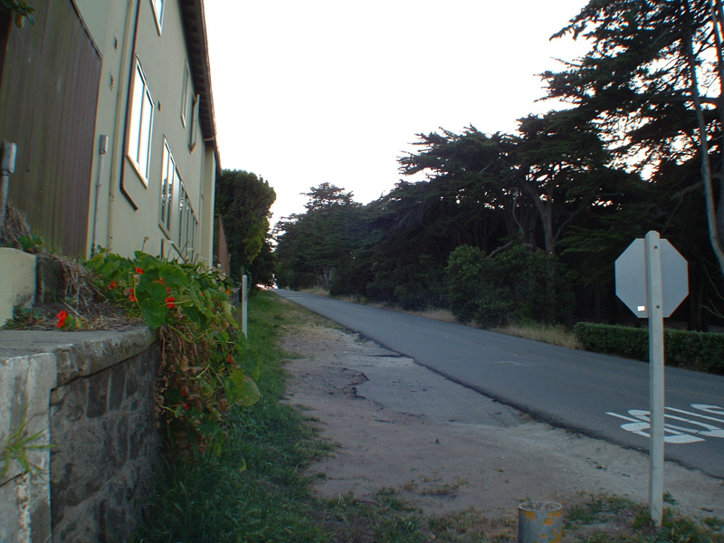
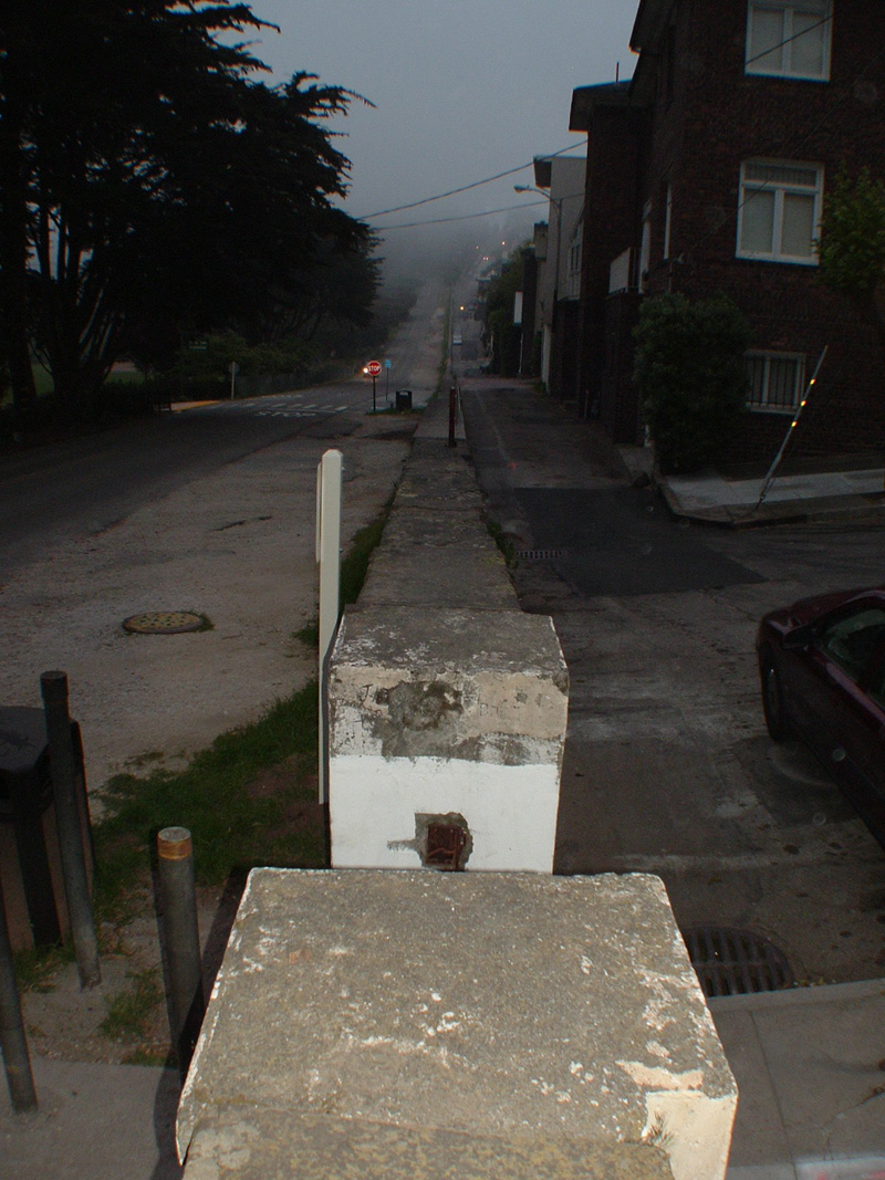
Looking north up the sidewalk witnesses say
Zodiac used to flee the crime scene. The victim's cab would have been to the right, just
out of the picture.

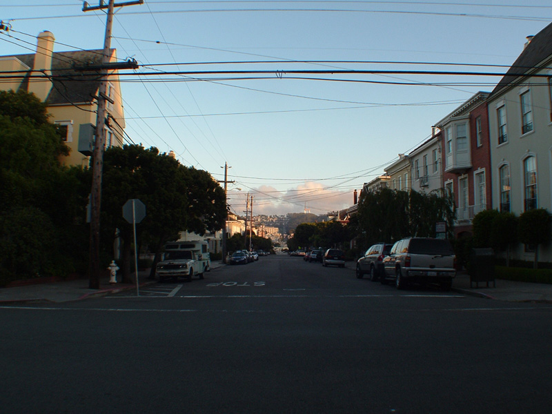
South toward the crime scene from about a
block away at the intersection of Cherry and Jackson Streets.

Immediately north of the Cherry/Jackson
location is a heavily wooded area called the Presidio. Unless Zodiac quickly changed
direction, he would have been virtually trapped.

The view east on Jackson Street from Cherry;
an easy walk "down the hill." |

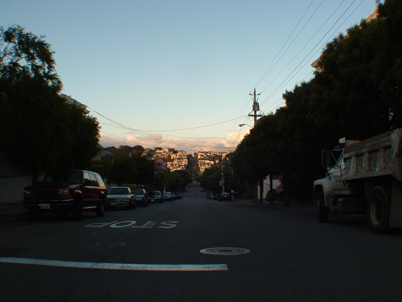
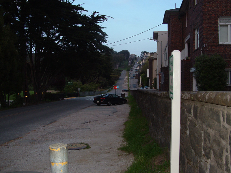
Approximitely "3 min" from the crime
scene is this area of Jackson Street (looking east). If Zodiac's account of events is
correct, he would have encountered the police officers here.

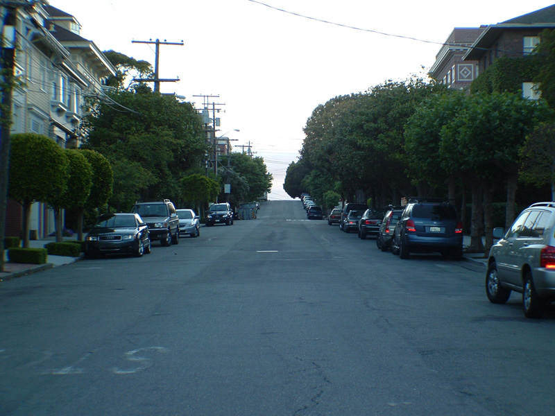
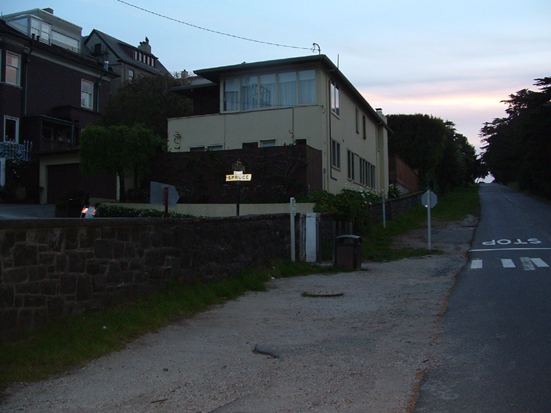
West on Jackson from Spruce Street. Cherry
Street is located at the top of the hill.

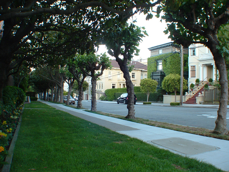
At Spruce Street and West Pacific, the persons
in this picture are precisely located "at the park a block & a half away"
from the Zodiac's encounter with the police.

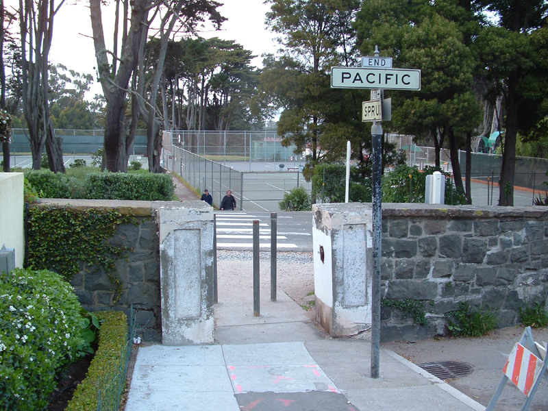
Spruce Street ends at the Presidio's five-foot
stone boundary wall. The wall runs approximitely east/west and the only opening in the
entire area is located here. Note "the park" in the background.

West on West Pacific just beyond the wall. If
Zodiac parked his getaway car here, it would have been well-hidden.

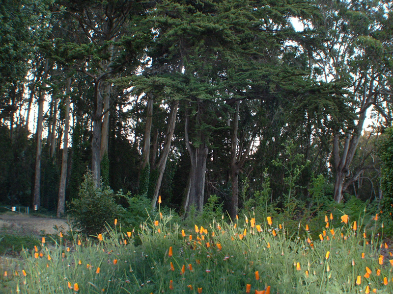
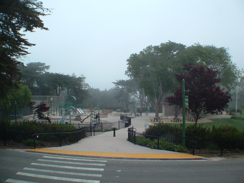
Just north from the wall's opening is the
Julius Kahn Playground, referred to by visitors as "the park."
-- BONUS VIDEO -- |

East on West Pacific. In this area of the
Presidio, parking is only allowed east of the wall's opening on the south side of West
Pacific.

Looking south beyond the wall's opening and up
the hill on Spruce Street from the entrance to "the park."

The parking area just inside the Presidio on
West Pacific. Escaping in either direction on West Pacific would have provided Zodiac with
quick access to the Golden Gate Bridge.

Looking east from the opening on the south
side of the wall. Altogether a very isolated area, traffic is quite sparse.

Another eastern view, this time from the top
of the wall. Too bad I wasn't perched there with my camera the evening of Oct. 11, 1969...

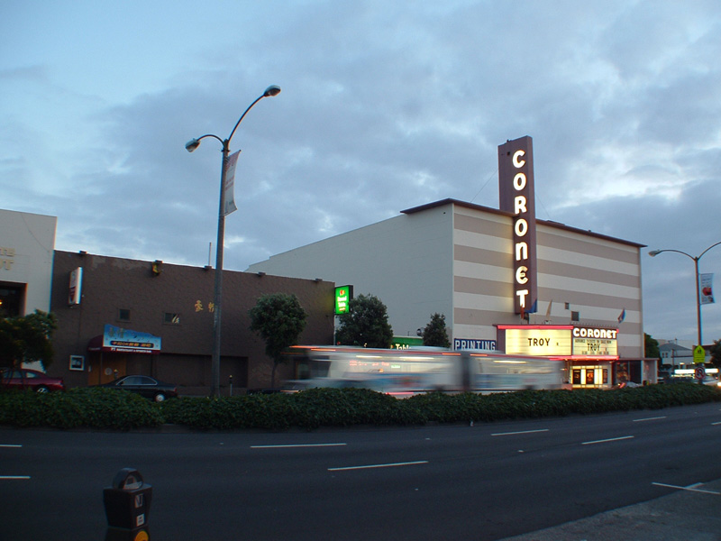
If Zodiac parked his getaway car on West
Pacific in the Presidio, how did he get downtown to the intersection of Mason and Geary
Streets where he hailed the cab? The most likely scenario is that Zodiac walked south
about 7/10 of a mile to Geary, where he caught a bus. Had Zodiac walked directly south on
Cherry Street to Geary, he would have run into "Z's Bountiful Buffet" (left of
picture, now closed), right next to the Coronet Theater ("Funny Girl" was
playing that night). Note the Geary bus streaking downtown. |


)
)